Constellations of the City
“Constellations of the City”(2014)
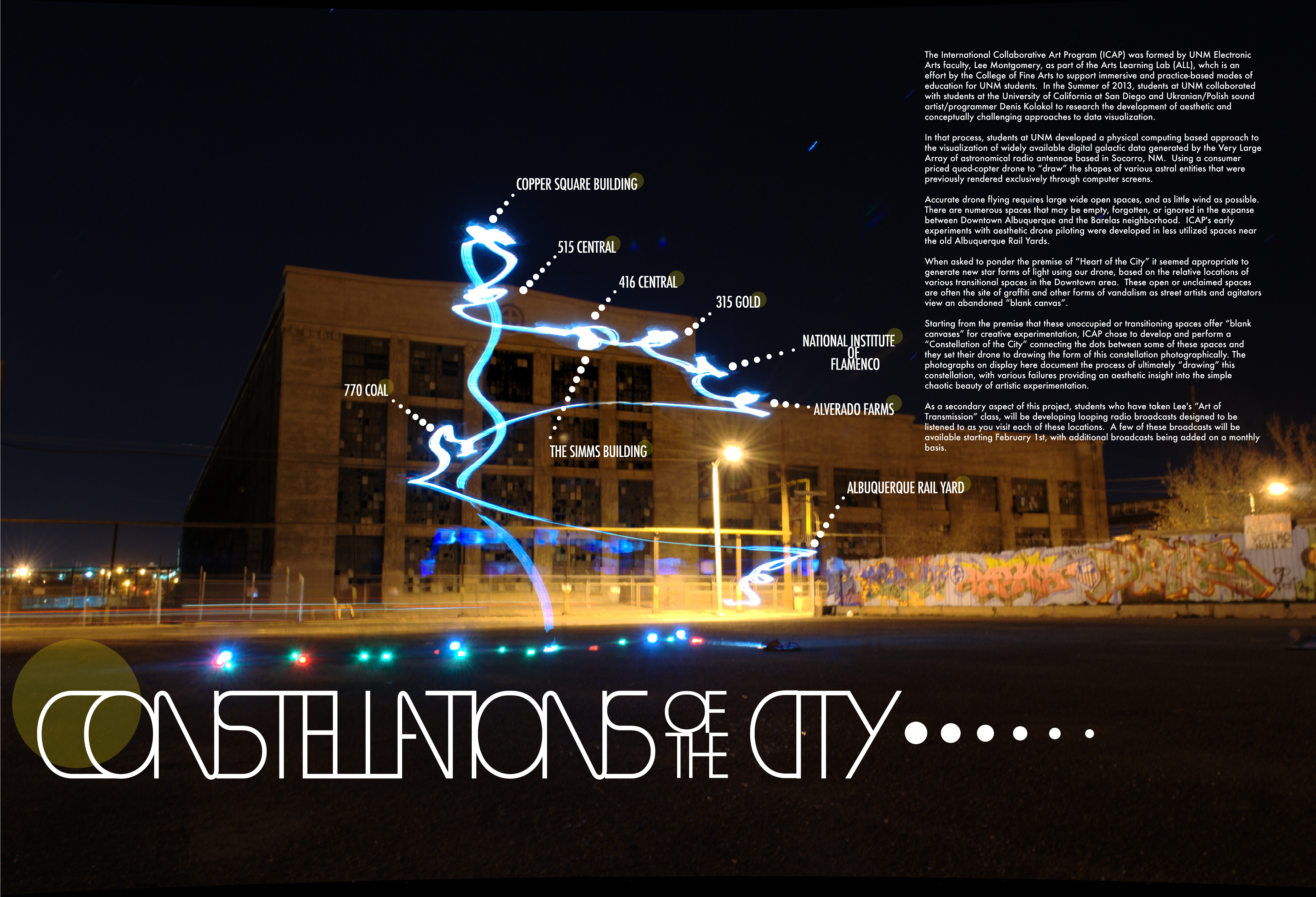
Constellations of the City (2014)
Constellations of the City is the final embodiment of  a series of drone based experiments with abstract line drawing, data visualizations and mapping.  It started with experiments between my International Collaborative Art Program(ICAP) class at the University of New Mexico and visiting artist Denis Kolokol. Initially we experimented with trying to use a Parrot AR drone to draw shapes related to data obtained from the Very Large Array in Socorro, NM (examples below).
After being invited to participate in a show at 516 Arts in Albuquerque, around the theme “Heart of the City” we worked on drawing data based forms related to more terrestrial maps.  After identifying points on the map of downtown that contained transitional spaces (unoccupied or under construction spaces at the time) we connected the dots on a map using the shortest distance between each point in order.  The resulting form became the flight path for our drone.  After numerous trials, and many gorgeous failures, we eventually managed to draw the form in the air with the long abandoned, but currently under development, Albuquerque Railyards as a backdrop.  Examples of failures and precursors were included as part of the show and are visible below.  There is also an image that was made as part of a visit to Tyler School of Art at Temple university in Philadelphia in collaboration with students in Leah Modigliani and David Demplewolf’s Visual Arts classes.  This is an attempt to apply this methodology to images created using maps of other cities.
Constellations of the City was reviewed on the International Sculpture Center’s blog by Adam Rothstein, and also featured as part of an article on the VICE Creator’s Project blog.
-

- “untitled VLA data experiment test” (2014)
-

- “untitled VLA data experiment failure” (2014)
-

- “untitled VLA data experiment failure” (2014)
-

- “untitled VLA data experiment failure” (2014)
-

- “untitled Constellations of the City failure” (2014)
-

- “untitled Constellations of the City failure” (2014)
-

- “untitled Constellations of the City failure” (2014)
-

- “untitled Constellations of the City failure” (2014)
-

- “Philadelphia mapping experiment. fighting wind and snow” (2014)